Nebraska Memories is here with another #ThrowbackThursday!
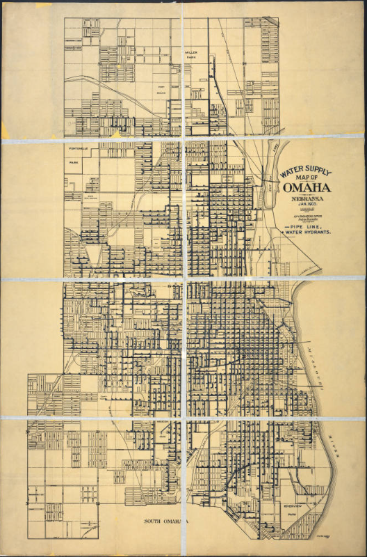
This map from January 1905 shows the water supply system of Omaha, Nebraska. A legend shows that the dark blue lines on the map represent the city’s pipelines, and the dark blue dots represent water hydrants. There is also a scale for size. Printed between the scale and the legend it says “City Engineers Office, Andrew Rosewater, City Engineer.”
This image is published and owned by the Omaha Public Library, and is specifically part of their collection of Omaha-related maps dating from 1825 to 1922. They also have a large collection of 1,100+ postcards and photographs of the Omaha area.
See this collection and many more on the Nebraska Memories archive!
The Nebraska Memories archive is brought to you by the Nebraska Library Commission. If your institution is interested in participating in Nebraska Memories, see http://nlc.nebraska.gov/nebraskamemories
/participation.aspx for more information.

